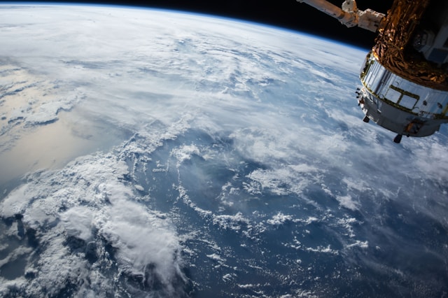
In ancient times there was a view that the Earth was shaped like a flat disc surrounded by a huge ocean. It was believed that our planet must be flat, because otherwise people would fall off it. It was believed that the rising stars and the Sun emerged from the ocean waters and plunged into it every day at sunset. Ancient Greece gave rise to the notion of the Earth as a giant sphere, suspended in outer space, or supported on the shoulders of the mighty titan, Atlas. As early as the 6th century BC, the mathematician and philosopher Pythagoras proposed the thesis that the Earth was a sphere. However, he only presented an idealistic proof. He claimed that the Earth is a sphere because it was created by the gods, so it must have an ideal shape, which is what a sphere has.
It was not until the 4th century BC. Aristotle presented realistic evidence for the Earth’s sphericity. He believed that over every place on Earth at any given time other stars are at the zenith. This can only be explained by the fact that the vertical directions at different locations on the Earth’s surface are mutually convergent to the center of the Earth, i.e. the Earth must have a convex surface at every location. Aristotle presented the following arguments for the Earth’s sphericity.
- Earth’s surface since it is perpendicular to the vertical at every point must be spherical in shape
- In ships appearing on the horizon, the mast is seen first, and then only the hull. Ships as they move away seem to disappear, sinking. The Earth’s horizon is circular, so the curvature of the sea surface gradually obscures the distant ship.
- Earth’s shadow visible during lunar eclipse is circular in shape
- The viewpoint is visible in the shape of a circle
Aristotle argued that the Earth has such a surface in which the particles of an earthly solid tend toward its center. This condition, according to Aristotle, is satisfied by a sphere. The Earth’s surface, however, deviates significantly from the shape of a sphere. During the Middle Ages, the conviction of the Earth’s sphericity disappeared, and it began to be considered a flat circle again. It was not until the Renaissance that the Earth began to be considered to have a spherical shape. After the circumnavigation of the Earth by Ferdinand Magellan’s expedition (1519-1521), further proof was obtained that the Earth was not flat. Juan Sebastian El Cano, captain of Magellan’s expedition, was the first man to circumnavigate the Earth….
Arguments proving the Earth’s sphericity allowed Alexandrian geographer and mathematician Eratosthenes (276- 195 BC) to measure the Earth’s circumference. Eratosthenes, assuming that the Earth was spherical in shape, made two measurements, one astronomical and the other topographical. He noticed that during the summer solstice at noon in Syene (today Aswan in Egypt), the sun’s rays illuminated the bottom of a deep well, so they fell, so the Earth was at a right angle. The sun was then towering at the zenith in that place. However, at the same time in Alexandria, the Sun was deviated from the zenith by 1/50 of the full circumference of the circle, or 7°12′. This allowed him to use Thales’ theorem and conclude that the compact angle between the plumb line and the sun’s rays at Alexandria is equal to the angular angle formed by Alexandria Syene and the center of the Earth. He also incorrectly assumed that the two locations lie on a single meridian.
Since the distance from the Earth’s surface between Alexandria and Syene was, according to Eratosthenes, 5,000 stadia, he concluded that the circumference of the Earth was 50 times this distance, i.e. that it was 250,000 stadia. Without knowing exactly the value of the stadia assumed by Eratosnthenes, it is impossible to assess the accuracy of his measurement, but it did not deviate significantly from reality. The result he got differed from the actual one by only 100 km. Eratosthenes showed that the shape of the Earth can be represented by taking a measurement of the arc length of the Earth’s curvature and determining its angular value by astronomical measurement.
Another scholar who measured the Earth’s circumference was Posidonius of Apamea, who measured the height of the star Canopus above the horizon simultaneously on the island of Rhodes and in Alexandria at the turn of the third and second centuries AD. Posidonius used the same method as Eratosthenes, but in his measurements he erred by two angular degrees greatly inflating the final result. Based on his calculations, he concluded that the circumference of the Earth was 53,000 km.
To determine the radius, and the circumference of the Earth as Eratosthenes and his followers did, it was therefore necessary to measure the meridian arc. The Earth’s radius can be calculated with the greater accuracy the longer the meridian arc can be measured. In practice, this is extremely difficult due to the unevenness of the terrain, and obstacles such as rivers, lakes, forests, etc. In the 17th century, it was proposed that direct measurements of the meridian arc be replaced by measuring angles in triangles arranged near the meridian. This method was given the name triangulation. Near the meridian arc, a number of points were placed no more than 25 km apart from each other. These points form a network of triangles in which angles are measured. To calculate the length of the meridian arc, a value of latitude was still needed, equal to the angle formed by the plane of the celestial pole with the plane of the horizon. Triangulation measurements led to increasingly detailed measurements, which geodesy took over.
Aristotelian ideas about the shape of the Earth were corrected by CH. Huyghens, and I. Newton in the 17th and 18th centuries. They knew that the Earth, according to Copernicus’ theory, spins around its axis. Thus, there are two forces acting on every body on its surface: one is the force of universal gravity, which is directed toward the center of the Earth, and the centrifugal force, which is directed outward from the Earth’s axis of rotation. It is greater the farther the body is from the axis.
The resultant of both forces is the weight of the body. The centrifugal force reaches its greatest values at the equator and is directed opposite to the gravitational force, i.e. at the poles the value of the centrifugal force decreases to zero. This force gives bodies at the equator at sea level an acceleration of 3.4 cm/s2 . Thus, the weight of the body depends on the latitude. Thus, bodies at the equator are lighter at the same mass than at other latitudes. The force of gravity is much greater than the centrifugal force. The average value of the acceleration it causes is 9.80665 m/s2 . The Earth’s acceleration observed at the poles is 9.83 m/s2 , while at the equator it is 9.78 m/s2 . Isaac Newton predicted the phenomenon much earlier than it could be determined by gravimetric measurements (measurements of gravity). He concluded that since the Earth rotates around its axis it must be flattened in the direction of that axis, and is therefore similar in shape to a rotating ellipsoid, that is, a solid formed by the rotation of an ellipse around its minor axis.
As a result, a body at the pole is closer to the center of the Earth, and is therefore more strongly attracted by it, than at the equator. If the Earth deviates in shape from a sphere, and since as it approaches the poles the curvature of its surface has a larger radius, i.e. is less convex, the meridian arc near the poles should be longer than near the equator. In 1744, measurements were made that showed that the Earth is indeed shaped more like a rotating ellipsoid than a sphere. The results of individual measurements of the Earth deviate from theoretical numbers. The differences are so large that they cannot be attributed to measurement errors. On this basis, it was concluded that the Earth is not shaped like a rotating ellipsoid, but has an irregular shape that cannot be described by any mathematical formula.
If the Earth were a perfect sphere, its surface would not be morphologically differentiated and the density of rocks and the thickness of the Earth’s crust would be the same at every point, then a measurement of the force of gravity at a given point would give a value equal to the result of a calculation of the value of this force based on latitude and height above sea level. However, because the Earth’s surface is very varied, the results of measuring the value of the gravitational force differ from the theoretical one. Comparing the force of attraction of the Earth with the force of attraction of any body of known mass, German researcher Philips Joly calculated the mass of the Earth in 1878. He placed two bodies of equal mass on the pans of a highly sensitive balance. Under one of the pans he placed a body of very large known mass. There was a deflection of this pan, which was balanced on the other pan by a weight of known mass.
Knowing the formulas for the force of attraction of one weight by the other, and for the force of the Earth’s attraction, he thus derived the formula for the mass of the Earth. Today, the mass of the Earth can be calculated by many more methods. The mass is approximately 6.98. 1021 tons. The Earth’s sphere is not made of uniform material. In the Earth’s crust there are rocks of different densities in one place. Near some mountain ranges, the vertical deviation from the direction perpendicular to the surface of the rotating ellipsoid was found. These differences are due to the structure of these mountains, and their mass. The mass of the mountains, rising above the surface of the ellipsoid, acts on the plumb line drawing it toward itself. The term geoid is now used to describe the shape of the Earth.
A geoid does not reflect the actual shape of the Earth. It is such a solid, which will be formed after leveling all elevations and depressions of the terrain to the mean sea level without affecting the distribution of the directions of gravity. A geoid, therefore, is a solid whose surface at any point is perpendicular to the vertical determined by the force of gravity. The main feature of a geoid, then, is that at every point the plumb line is perpendicular to the plane tangent to its surface. It is convex, but its curvature varies irregularly in different places and deviates from the ellipsoid by distances of more than a hundred kilometers.
Over the oceans, the geoid runs mostly above the ellipsoid, which is indicative of the relatively large masses of rock that build the ocean floors. At the site of young mountains, the geoid mostly runs above the ellipsoid. The reason for this is that these mountains are characterized by smaller masses. Accurate determination of the geoid is possible after studying the anomalies of the force of gravity, that is, deviations from its theoretical distribution. For this purpose, gravity measurements are carried out. The development of satellite geodesy in the 20th century made it possible to make more detailed measurements and thus determine the shape of the Earth more precisely. Thus, it was recognized that the Earth is a cardioid ellipsoid, that is, a pear-shaped or heart-shaped solid. It was proved that the Earth’s hemispheres are not symmetrical at all. The radius of the south pole is about 1 km shorter than the radius of the north pole. Also, the parallels in the southern hemisphere are slightly longer than the parallels in the northern hemisphere. Polar flattening, on the other hand, is characterized by larger values in the southern hemisphere.
Based on the very numerous measurements made in recent years, the following dimensions of the globe can be assumed:
- Average equatorial radius- 6378 m
- Average polar radius- 6356 m
- Medium radius- 6371 m
- Earth’s circumference at the equator- 40075 km
- The circumference of the Earth along the meridians- 40007 km
- Difference in equatorial and polar radius- 21385 m
- Earth’s surface- 510 million km2
- Volume of the Earth- 1083 billion km3
- Gravitational acceleration at the equator- 9.78 m/s2
- Gravitational acceleration at the poles- 9.83 m/s2
- Difference of the two half-axes of the equator- 213 m
- Difference in polar radii (rpd – rpn )- about 70 m
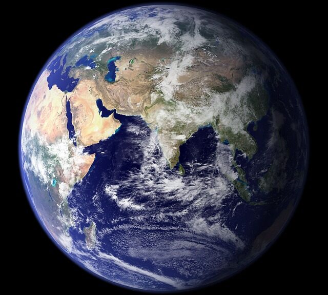
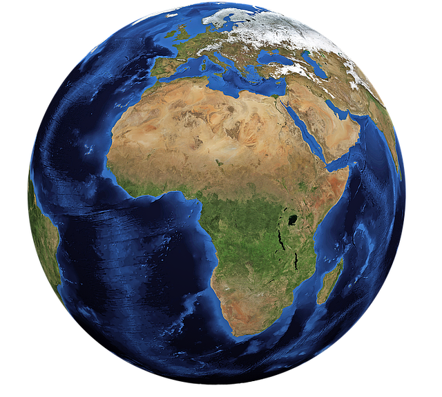
Summarizing the above considerations, it can be said that to determine the shape of the Earth, and its size, not only distance measurements on its surface are used, but also astronomical, satellite, and gravimetric observations are made. The Earth’s body has an irregular shape, even if one does not take into account the elevations and depressions of the terrain. The most common term for the shape of the Earth is the term geoid, which by its shape is similar to a rotating ellipsoid. The Earth’s ellipsoid is shaped like a sphere so, simplifying in geographical and astronomical considerations, the spherical shape of the Earth is assumed.
Earth’s movements and their consequences
The Earth’s sphere is in motion. It rotates around its axis ( rotational motion, also called spinning motion), and revolves around the Sun ( circular motion). The Earth’s motion is not perceptible to us. The problem of the Earth’s rotational motion was correctly solved by Copernicus (1473- 1543), as was the Earth’s circular motion around the Sun. At present, it is possible to give those phenomena that depend on the Earth’s movements and are evidence of their existence.
Earth’s rotational motion
The rotation of the Earth is the rotation of the Earth around its axis. The time of one rotation is 23 hours 56 minutes and 4 seconds and corresponds to one stellar day ( a stellar day – the time between two highs of the vernal equinox point). A day, however, is called the time that elapses between two consecutive sun rises over a given meridian ( solar day). The solar day lasts 24 hours. Rotational motion is from west to east, that is, in the opposite direction to the Sun’s apparent motion across the celestial vault. As a result of the rotational motion, the Earth’s surface is unevenly illuminated. The illuminated hemisphere is daytime, while the unlit hemisphere is nighttime. The reason for the rotational motion is also the flattening of the Earth at the poles, that is, the difference between the polar and latitudinal radii. The flattening of the Earth is about 21 km. The speed caused by rotational motion varies throughout the globe. The highest linear velocity of moving points is observed at the equator and is 1670 km/h.
As one moves away from the equator, this speed decreases. At the 50° parallel it is already 1104 km/h, and at the poles it is 0 km/h. Symptoms of deflection of bodies in motion can be found in the shifting of air masses. As a result of the uneven heating of the Earth’s surface, a global air circulation is formed. On a globe that would not perform rotation, these shifts of atmospheric air masses should take place in a meridional direction. As a result of rotation, and the action of the Coriolis force, deviations from the meridional directions of the tracks of a body moving, along the Earth’s surface, toward the equator in a westerly direction in both hemispheres, and in an easterly direction when the body moves toward either of the poles, i.e. toward the axis of rotation, are created at the Earth’s surface. The discoverer of the Coriolis force was French mathematician Gaspard-Gustave Coriolis. The Coriolis force is expressed by the formula:
А= 2 ω υ sinφ
where:ω – angular velocity of the Earth’s rotation
υ – speed of motion of the particle
φ– latitude
The diurnal rotation of the globe also causes falling bodies to deviate from the vertical direction to the east. At high altitudes, and with accurate determination of the direction of the plumb line, the deviation can be easily observed. Such an experiment was performed in the early 19th century by dropping appropriate weights from church towers. For example, in 1802, with experiments performed in Hamburg, a deviation of 9 mm was obtained from a church tower 73 meters high. According to calculations, the deviation should be 8 mm. Another evidence of rotational motion is the changes in the value of the Earth’s acceleration depending on latitude.
This is because the body moving closer to the axis of rotation retains a greater linear velocity. North of the equator, this force causes the trajectory of moving objects to curve to the right (from the point of view of the moving object), while to the south it curves to the left. This effect is not usually felt, and manifests itself only in the case of prolonged processes or in the case of bodies moving freely over a large area. In the northern hemisphere, the wind tends to turn to the right, while in the southern hemisphere it tends to turn to the left. Also, the right banks of rivers occurring in the northern hemisphere are more strongly washed up, while in the southern hemisphere they are left.
In the northern hemisphere, cyclones move counterclockwise, while in the southern hemisphere they move clockwise. Rotational motion also causes the movement of tidal waves caused by the gravitational interaction of the sun and moon. Over almost the entire globe except the polar regions, rotational motion causes a diurnal change in illumination, i.e. the succession of day and night, and a diurnal rhythm of changes in the Sun’s height above the horizon. Evidence of the Earth’s rotational motion is Foucault’s Pendulum-it is a pendulum that was constructed in 1851 by Jean Foucault. It was shaped like a long eleven-meter pendulum suspended in the Pantheon in Paris This pendulum has the ability to swing in any plane. By setting it in motion, it should maintain its direction. However, it turns out that the pendulum does not change its plane of oscillation only at the equator. The plane of oscillation of the pendulum in Foucault’s experiment changes uniformly with respect to the Earth making a rotation from east to west. Numerous witnesses could see that the line drawn by the direction of the pendulum slowly rotated relative to the floor and walls of the Pantheon. In fact, the Pantheon rotated along with the Earth, while the direction of oscillation remained unchanged thanks to the phenomenon of inertia. The angular velocity of rotation of this pendulum’s plane of oscillation depends on the latitude of the place where the experiment is performed. At the equator, the plane of oscillation of the pendulum does not change The change in the plane of oscillation is caused by the rotation of the Earth around its axis.